Thursday, August 21, 2014

Whales, Fog, and Diesel Fumes

Ellen

We got up at 6:00 to break camp and catch the 7:23 slack tide to make our crossings. We decided that in order to make the ferry time we wanted and get home at a decent hour that we should make our crossing today. That way, all we had to do the last day was a couple of miles back to Telegraph Cove. We packed up as quietly as we could so as not to disturb our neighbors and set out at 7:18. It was foggy, of course, but we were treated to one last view of the humpback whale as he surfaced about 50 yards in front of us. We crossed in thick fog. I had nothing to keep my bearings; I actually thought we were crossing to Compton Island to be safe, but we were actually heading directly across Blackfish Sound to Hanson Island. The fog broke a bit as we rounded the east side of Hanson after a fast, 20-minute crossing. We made our way through a narrow passage that proved to have a swift current against us.

Beyond that, we grabbed the main current--in our favor--and made a diagonal crossing to our campsite on Blinkhorn Point. Fog engulfed us a few times and we had to wait for the passage of a few fishing boats. It seemed odd at the time that all the fishing boats were also headed for Blinkhorn. In retrospect, I realized that they all went there to sell their catches to a larger fishing boat. Thus, the quiet little cove was full of diesel fumes, boat engine noise, and running generators. The campsites were not great either. They were tucked back into the woods a ways, with rotting picnic tables. At low tide, the beach was very long, covered in river rock rather than the pebbles we had experienced everywhere else. We both took a look around and decided not even to eat our breakfast there.


We paddled the last few miles to Telegraph Cove and ended our trip a day early. We took out on the dock and ate our breakfast--a rehydrated breakfast casserole of egg, hash browns, and sausage with toast. I had boiled it in the Dutch oven before we left Flower Island and then wrapped it in John's coat. By the time we got to Telegraph Cove three hours later, it was ready. It was a little cool but otherwise good!


We took showers at the cove for $1 per minute (Loonies only). It was wonderful to get clean! It took us about two hours from the time we docked to the time we began our drive to Nanaimo. Unfortunately, our day had only just begun. Though we arrived for the ferry and hour and a half early, we didn't get on the 5:45 sailing because there were so many people with reservations. We had to wait another two and a half hours for the 8:15 ferry. We made dinner in the parking lot--I rehydrated a tortilla casserole. We treated ourselves to an ice cream cone for dessert.


We had more waiting in store for us; getting off the ferry in Tssawassen, the ferry from Victoria was also unloading so there was a traffic jam at 10:45 at night on a Thursday. There must have been a delay somewhere because the two ferries don't usually unload at the same time. A traffic jam at the terminal also meant a delay at the border. After waiting about 15 minutes with only one lane open, fortunately, they opened a second booth and we were across the border in another five minutes. Every hotel I called in Bellingham, (by this time it was midnight), was completely booked, so we ended up driving all the way home, arriving at 2:00 am.


Though our last day was longer than long and the campsite a disappointment, I refused to let the day sour the experience of a lifetime. We had such a memorable journey in the Broughtons. I considered it to be my favorite of all our paddles. We enjoyed it so much that we began planning a trip for next summer while we waited for the ferry. Next time, we want to get up to Echo Bay and see the Burdwoods, camping at Cedar and Insect Island along the way. There is so much to do and explore. We will likely spend the rest of our kayaking days there.


I am a lucky person to be able to share such adventures with my partner, my best friend, my inspiration. Gaining the courage to do such trips has allowed me to experience places and sights many never see, giving me confidence, joy, and deep satisfaction. We share a good life.


             I never would have imagined such a beautiful base camp. Flower Island is a place 
                                                            to remember.


John

Sadly and silently we broke camp. We discussed plan a and b routes the night before and again in the morning. We made our decision according to the conditions on Blackfish Sound. It was foggy but calm and we were at the beginning of the slack. We headed across the sound instead of taking the longer but safer route to Compton Island and Blackney Passage. A few minutes into the paddle we heard the whale. Ellen saw it surface in front of us. Looking at the camera, I missed it. The fog was thick. We were going between 3-5 mph as we crossed to Hanson Island and south of Mel's Beach. 


We paddled across Blackfish Sound in the fog. I was getting my GoPro on and recording when Ellen saw the whale, so I missed it. 

As we headed into the Blackney Passage, I thought about a kayaker that told a story about a couple he came across after they had paddled the passage. Apparently they were not too concerned about slack tide as a good time to paddle Blackney Passage. They got caught in the passage at a peak and experienced rips, whirl pools, and boils. They clung to kelp in order not to be pulled into turbulent water. The kayaker telling the story said he had seen a whirl pool 2.5-3 meters deep in that passage. Scary stuff. We hit the passage during an ebb slack so the water should have been mild, which it was, and in our favor, which it wasn't. The current ran against us like a river. We had no problems because Ellen steered us near the shoreline where we found weaker currents and eddies. 

Once we hit Johnstone Strait, we rode the ebb across to Blinkhorn Point. We wasted too much time there looking for a campsite and decided to paddle on to Telegraph Cove, skipping breakfast. As we rounded the last point prior to the cove, we encountered several tours making their way out of the cove. Everyone was using the slack tide. We used the dock to exit the double, eat breakfast, and unpack. As we were going about our business a tour group landed across from us. I watched one client struggle out of his double. He had a Swiss type of hat with a feather sticking out the left side. It looked like he had cotton for his outer layer. He reached into his cockpit and pulled a large gray case out of his cockpit by turning and twisting it. It was a guitar case! I always thought grade school teachers were angels. I will now throw in that heap tour guides after seeing that. Whoa. Maybe he was the tour guide.

I mentioned earlier I would describe my thoughts about B.C. Ferries. I had generated enough bad karma with not helping the two young kayakers the day before, so, not needing more bad karma, I will let Ellen explain. At least they got us safely across to the mainland.  

The Broughton Archipelago is a paddler's dream location. Once we get the ferry situation, slack tide, and currents in the area figured out, we will return for numerous future trips. We will base out and then move on to a different base covering lots of water and hopefully experiencing more whales, Orcas, porposies, and eagles. Using the various resorts for resupply drops, showers, change of clothing, and a bed now and then, we could easily spend a summer in the Vancouver Island waters.

I would mention the possibility to my wife and paddle partner, but I am sure she has already made plans for revisits.

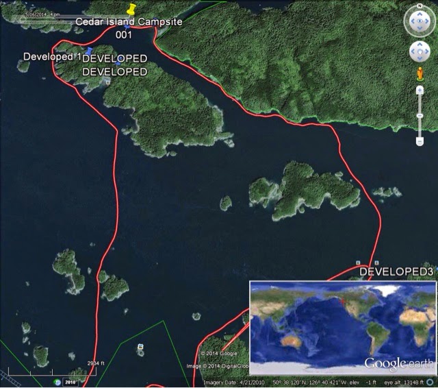
The red line on the right is our route across Blackfist Sound in the fog during slack tide.

GPS summary:
Flower Island Start paddle at 7:18 am 3-5 mph
Arrived at Blinkhorn Point at 9:14 am 7.5 miles
Leave Blinkhorn Point at 9:45 am
Arrived at Telegraph Cove at 10:30 am 3-4 mph 3.1 miles for a total of 10.6 miles
We packed up the car and took showers.
We left Telegraph Cove at 12:15 pm.
Arrived at ferry terminal at 4:16 pm. Missed ferry and waited 2.5 hours for next ferry.
Caught the 8:15 pm ferry.
20 minute wait at border due to one booth was open.

Wednesday, August 20, 2014

Knight Inlet

Ellen 

Once again, we got to sleep in. John got up before I did, but I somehow managed to sleep until 8:20! It was foggy when I got up, as usual. We had breakfast out on the point: oatmeal with fruit puree, peppermint tea. Slack tide began about an hour later around 12:20. The whole wheat tortillas I brought to make almond butter banana wraps molded, so I had to pack a freeze-dried meal.


Early in the day, it looked like the fog would burn off early, but it gathered again by noon when we got ready to leave.


Fog was perpetual on this trip, and it never really left the water completely. It would begin to gather again in the late afternoon before it could clear away.


We headed for Swanson Passage, which to our surprise, had a really strong current that we had to paddle against. We had our usual mix of fog and sunshine, both of which linger throughout the day. Once through the passage, we had a much easier time paddling to what the chart called a "good beach" on Creasy Island. It was a gorgeous beach with nice campsites just inside the treeline and a granite pebble beach. There was a tour group their with their guide who came over to chat with us. He gave us some good information about various campsites in the area, which we made note of for next summer's trip. 


As we emerged from Swanson Passage, we saw several small islands, one of which was called Lone Tree and another Dot. They were like ghosts in the fog.


After having a lunch of freeze-dried Turkey Thyme (which was quite good), we set out across Knight Inlet to head up a passage to Cedar Island. We wanted to check out the campsite there for next summer's trip. Again, the current in the passage was strong, but moving slower meant we could enjoy the incredible scenery more! We finally emerged and located the campsite, where a few paddlers seem to be taking a rest. Directly across from it on Owl Island was another campsite. We waved hello and continue around the west side of Owl. Once back in Knight Inlet, we cross again to enjoy the close-nit islands, Twist and Whirl. They were one of my favorite spots. The white rocks of the island came right down into the water, and the blue-green water was so clear, I could see the rocks underneath. It was really beautiful. 

We headed back for Swanson Passage, thinking the next break in the trees was it but it turned out to be a small cove. Just a little farther along was the passage. We had a little current to contend with, but not like before. We quickly made our way back to Flower. 

Once again, we hustled our kitchen and dinner out to the point, though this time we stayed on the rocks out of the wind because I was a little chilled from paddling in neoprene all day. We had our best dinner of the trip: chicken enchiladas verde. Definitely good and definitely easy! Our movie that night was OK: Blood Type Unknown. It was an intriguing idea but not very well executed.


I took a selfie at the dinner site. 

John

While Ellen slept in, I moved my attention to the west side of the island. I had heard the whale early in the morning and thought it was really close to our campsite. It was. It was fishing about a hundred yards north of our site. It would come up for air and clear it's spout and go back under the surface. It continued the short dives three or four times and then did a deep dive with the tail going up in the air. While it was under the surface, I spotted a pod of Orcas moving north through Blackfish Sound. I love their sound. There were four or five smaller ones surrounded by two or three larger ones. Another one was off to their west side and treading water as it was diving. It must of had a school of fish in that one small area. Another group followed and were more spread out than the first group. They were moving slower through the sound. With all of them in the same general area I could heard their distinct breathing repeatedly. It gave life to the fog. The humpback whale appeared a mile or so south of it's last dive. It seemed to be keeping its distance from the Orcas.

When the Orca show was over, Ellen joined me with breakfast in her hands. We ate and enjoyed watching the fog lift and thin here and there and thicken in other places. The whales continued to be heard but not seen in the fog. It was a relaxing morning. We made our way slowly back to the campsite and our neighbors had already left. I caught a glimpse of one of their doubles heading west alongside Swanson Island.

Our launch time was scheduled for the ebb slack tide which was at 12:22 pm. The fog rolled out, the fog rolled in as we waited. I took a photo of the island east of us as it sat covered in fog. I checked the NOAA weather channel for the latest forecast. They were predicting fog until noon and gale force wind warnings for Johnstone Strait later in the day. 

A small island east of our camp and not only in West Passage but in the morning fog.

We returned to camp at 4:25 pm after a 13 mile paddle. We averaged between 3-4 mph. We need to boost that to 4-5 mph. Reading and riding the currents correctly in that area would go far in helping us cover move water in less time and effort.

The return paddle from Cedar Island was beautiful. We hope to camp there next summer.

Our neighbors returned about an hour later. They told us they had paddled west along Swanson Island's south shoreline and watched the many whales off the far western point. They described one whale as having a respiratory problem. They completed their paddle by going through the West Passage.

The evening was beautiful from our place on the rocks. We had discussed the day's paddle and felt good about our findings as we listened for the whale. As we talked about future trips to the area we saw two singles making their way down West Passage and they pointed their bows toward our campsite. More neighbors, I thought. We continued with our wine and discussions about the day and what we should do tomorrow. The two paddlers suddenly appeared standing on the rocks to our left. They maintained a certain distance from us as if they respected our space. They asked about the site and how many campers were already set up. We replied with short answers.  

They seemed tired from being on the water all day. They were college age and fit. They both had their PFDs on as they made their inquiries. One was shirtless and was tanned around his PFD. The other, the spokesman, looked like he had been weathered from being outside 24/7. Nice people. They would have made good neighbors. They needed a place to rest and sleep. We didn't encourage them to stay, nor did we discourage them. They left the rocks and we both thought we would find them set up in the campsite when we returned from our rocks. We soon saw them back in their kayaks and headed south to the next campsite. 

As I watched them paddle slowly away, I felt like I had let them down as well as myself by not encouraging them to stay with us. I thought back to how many people helped me and encouraged me on my five-week paddle on the Missouri. Once, at Cascade, MT, I had to portage my single and gear two miles. Trucks and pickups zipped by me without a one stopping and offering me a ride. I promised myself at that time to help any hiker, biker, or kayaker that I ever came across who looked in need of a helping hand. I missed my opportunity with those two kayakers. Darn it. I must be a slow learner.

We went to bed early in order to break camp and catch slack tide for the Blackfish Sound crossing early in the morning. It had been a very enjoyable day. The movie was weird.


The red line shows our route out of Swanson Passage to the developed campsite at "good beach" and then to the east side of Jumble Island and into Providence Passage to Cedar Island. The two small islands we paddled between are Whirl and Twist islands.

Summary:
Start paddle to Cedar Island at 12:22 pm 2-3 mph
Lunch at Good Beach at 1:00 4.1 miles
Left Good Beach at 2:05 pm 3-5 mph
Arrived at Cedar Island at 2:48 pm 3-4 mph
Arrived at campsite at 4:25 pm 3 mph 8.9 miles from Good Beach for a total of 13 miles.

Day Trippin'

Ellen

One of the benefits of basing out from Flower Island was that we got to do some day paddles in a light kayak. No packing up camp and making umpteen million treks to the kayak at low tide. It was so freeing to just get into the kayak and go! We packed a lunch of course and a change of clothes just in case, but otherwise, we were travelling light.

We got to sleep in until 8:00 that morning since slack tide was not until 11:40. We had a simple breakfast of a muffin, which I heat up, and a banana and some peppermint tea, which we enjoyed out on the point. We spent a few hours watching the whales and reading, and then got ready for our day paddle.

We headed east hugging Swanson and Creasy Island as we made our way through Village Channel to the Indian Ruins on Village Island. We had a little trouble locating it; we nearly passed the cove, and even when we paddled into the cove, we thought it might not be it. We paddled a little further along into an area north of the ruins which was really quite pretty. We finally decided the first cove was the right place, so we took out and made our lunch there. We had salmon chowder and bread. While I was cooking, John brought me a surprise for dessert: some blackberries he'd picked along a trail to the ruins.

As for the ruins, they weren't much: just a big log on top of two upright logs. There were a few vertical poles that must have once been totems. The beach was covered in broken glass and ceramics (plates). I am not sure if that was meant to be a deterrent or what. It was definitely uninviting. After lunch, we quickly moved on.

We headed south toward Dead Point. There was another Indian ruin there, but not having been impressed by the first one, I suggested we paddle on. We took the southern route back to Flower through Indian Channel, tucking around the south end of Mound Island. It was a quite route back. We encountered quite a bit of current and a rip tide as we made our way back to Flower around the unnamed island right across from it. There were a couple of other paddlers in front of us who got carried right out into Blackfish Sound due to the current and rip tide. We steered hard for the shore of Swanson and avoided the sweep. I was a little disoriented as to where Flower was because the little island blocked our view of it. Once Flower came into view, it was still strange because at high tide, there is no beach on Flower. 

We got back to camp in the late afternoon. I gathered the kitchen and dinner items and John helped me pack them out to the point. We had wheat crackers with "backpack bruschetta," some pinto grigio, and pistou (a French vegetable soup with pesto stirred in). We watched the whales and the sunset once again. When it was time to turn in, we watched an unexpectedly good movie, The Secret Life of Walter Mitty. I slept quite well.


        John packed the Dutch oven and a camp chair out to the point so we could make dinner.


John watched the whales again--there is just a little spray in the distance, center, right up against the island in the distance.


As the sun began to set, everything was tinged golden. 
John looked amazing in the evening light.

John

We slept in and enjoyed a lazy morning with breakfast on the rocks while listening and watching for the whales as the fog lifted. I liked this basing out idea. Slack wide was at 10:52 am and we had the kayak packed and ready to go by 10:30 am. The kayak was light with only survival gear and extra clothing and our lunch items. As we started east through West Passage, we encountered a strong ebb current, slight whirlpools, and a rip tide, all of which we paddled through to flat water. Thanks to our chart and GPS, we made the correct turn at Farewell Harbor Resort and continued on to Village Channel. We encountered a guide with a family in two doubles. They were viewing pictroglyghs on a rock wall hanging above the clean blue, green water. 

Why did we encounter the strong current? We left with the slack tide. I asked the guide the question as we passed by the group and he was unable to answer the my question. I am guessing slack is early the further you are from Weynton Island, which is the measuring point for tides in the area.

We arrived at Meem Quam Leese ruins and paddled by it thinking what we were viewing was not the ruins as advertised. They weren't in the next cove either so we returned to the first cove and beach. That was at 12:38 pm. As Ellen made lunch, I walked up a trail to the ruins and got distracted by the numerous blackberries begging to be picked. I gathered two handfuls and headed to our lunch site and served them to the chef. She loved them. We left the ruins at 1:33 pm without exploring the site.

Our return paddle route was south toward Dead Point and west through Indian Channel which took us along the south shoreline of Mound Island. The water here was very well protected and the scenery was beautiful with the assorted trees on granite rocks that seem to hover above the clear water. As we paddled through the channel we could see huge granite boulders under us in the shallow water. We passed through a short, tight passage on Mound's west side and encountered a large tour group established at the campsite which overlooks the passage. Ellen said "hey" and got one response back. We rode the ebb current past Farewell Harbor Resort and into West Passage and caught a strong current which grabbed two of three singles that had glided in front of us from Swanson Island's shoreline. They ended up passing their campsite and had to paddle out of the current and back up West Passage to their site on Swanson Island. Ellen anticipated the strength of the current and steered us toward the Swanson Island shoreline before the current pulled us into Blackfish Sound. We arrived back at camp at 3:18 pm after a 14 mile easy paddle. 

Our campsite companions arrived about an hour after our arrival. We were hoping to find that they had left Flower Island and moved on. They must have decided that the area was worth basing out from. 


I followed as Ellen headed out to the point to make dinner.


Ellen enjoyed the sunset and the whales. 
We just never got tired of seeing them!


Dinner and wine and whale watching on the west side completed the day for us. We returned to the tent to find a dampness inside. We had left all the vents open during the day. Still, we enjoyed the warmth of the bags and comfort of the mats and our movie. What a nice day! I think I enjoyed basing out. 

We both got up sometime during the night to pee.  We saw stars in the night sky and marine phosphorescence in the salt water. The waves lapping on the shore made them appear to dance up on the shore and back into the water. It was delightful to view. A first for us.


Blue line indicates our route to Meem Quam Leese ruins. The combination of red, blue, 
                     and green lines show our route back to Flower Island.

Summary: Start paddle to Indian ruins at 10:52 pm 4-8 mph
Arrived at ruins at 12:38 am 7.4 miles
Left ruins at 1:33 pm 4 mph 
Arrived at campsite at 3:18 pm 3-5 mph 6.8 miles for a total 14.2 miles
Wine and dinner at 6 pm, movie at 9 pm
One pee break during the night.

Tuesday, August 19, 2014

Port McNeill

Ellen

We began our day at the early hour of 4:30 to shower, pack the last few things in the car, and leave by 5:30, which John pushed to 5:20. We were to the border in two hours and waiting at the ferry terminal at Tssawassen by 8:47, coming to a stop at the front of the line, just as the 8:45 ferry pulled away. Don't get me wrong; we didn't miss our ferry. We were planning on the 10:15 ferry. We just overshot our "get there with a little cushion" timing.

After stopping at a sporting goods store in Nanaimo for bear bangers, which had been recalled from that store, we finally got out of town, heading for Port McNeill. It took us nearly five hours from the time we left the ferry dock. We stopped in Port McNeill for dinner at Gus' Pub (John had a Southwest chicken salad and me a turkey sandwich), and then went a few miles north of town to Cluxewe, a small resort owned by First Nation people. We had a delightful cottage with a full kitchen and a great view. We watched the sun set and turned in early.


                            John enjoys the cottage porch as the sun sets at Cluxewe.


We were up at 7:00, and after showering, I made scrambled eggs and ham with toast. By 8:00, we were heading for Telegraph Cove about 10 kilometers south of Port McNeill. The fog was so thick there was a mist in the air and everything was wet, even the chairs under the porch. We hoped for the fog to clear for our 11:00 launch.

John

Trying to be positive, I will leave the B.C. ferries wait and the six hour drive to our night's stay for another post. At least our brakes were operating properly. Our cottage at Cluxewe was nice. It was small, warm, dry, clean, and had a kitchen. Even our neighbors chipped in helping make our short stay enjoyable by providing me with entertainment. They were a bunch. Probably three generations that were staying in a cabin two sites from us. The younger couple had two small dogs which they kept on leash and tended to regularly therefore not breaking any rules stated by the many posted signs in the area.They all seemed nice and loved their wine and beer. It must have been a family reunion because their conversations were catching everyone up on the latest activities each had been involved. They listened politely to each other's descriptions and through the conversation dance each had a turn to discuss their own recent activities. 

While the dogs were playing, the bunch moved in and out of their cabin and I saw two huge eagles land in a tree next to their cabin. One landed high and appeared to be watching the dogs playing on the grass in front of the picnic table. The other eagle landed lower and disappeared behind the fir boughs. The branch dipped from the extra weight. I watched for a few minutes as the movement of people slowed. Everyone was inside the cabin probably dishing up dinner. Suddenly the fir boughs opened and the branch moved quickly upwards as the huge eagle left its perch and dove toward the smaller black and white dog. The dog sensed the attack and leaped up to snap at the diving eagle. The eagle smartly withdrew its extended talons and flew off. The young owner stepped outside with a plate and beer in his hands just in time to see the eagle flying away. He had no idea of how close he came to finding his puppy with a broken spine. Anyway, that is how I remember our trip to Port McNeill and our stay at Cluxewe. Cool.

Sunday, August 17, 2014

Planning the Trip to the Broughton Archipelago

Ellen

With Vargas under our belts, or should I say spray skirts, we were ready for the next adventure. The woman on Ahous had recommended paddling in Johnstone Strait. In doing some research, we stumbled upon the Broughton Archipelago on the internet. I ordered another BC boating atlas that includes Johnstone Strait and the Broughtons.

Originally, we planned out a trip as we usually do, camping at a different place each night. Over a few glasses of wine after dinner, we planned to cross Johnstone Strait, round the west tip of Hanson Island and lunch at Square Notch Beach or Mel's Beach, and then cross Blackfish Sound to Flower Island to make camp. The next day we planned to make our way up to Cedar Island by going through Swanson Passage and crossing Knight Inlet. For our third day, we were going to go to Village Island to see the Indian ruins and then take Village Channel to another ruins site and camp there. We would return to Hanson Island and make camp the next night at Square Notch or Mel's. Our final morning would be a quick crossing of Johnstone Strait back to Telegraph Cove.

On the drive up to Vancouver, however, we decided that we would base out from one location if we liked the campsite. We chose Flower Island as our base camp due to its central location.

John

I like Vancouver Island for kayaking. The scenery is overwhelming. It demands return trips in future summers. Making sure the Garmin saves the waypoints, having a good chart in my map case, and understanding slack tide in the area would be accomplished before I launched again.

After spending five weeks on the Missouri River, a short jaunt out to Cypress Island in the San Juan's, and a enjoyable paddle around Vargas Island, I sense I was burned out. Not from paddling, but from setting up and tearing down camp, packing up the kayak, and the numerous early morning starts. I was ready to base out. If we could settle in on a nice campsite for a few days, we could paddle a light kayak doing routes from and around the camp. The campsite would remain intact. We had never done that before. I needed it.

A Little Kayak Safety Refresher Course

Ellen

After much discussion of our open water experience making the crossing from Whaler Island to Vargas Island, we realized how remiss we had been not practicing a wet exit in the Whisper. On a hot afternoon, we put on our full neoprene gear and paddled onto Lake Sammamish from the boat launch. With all the boats, jet skis, and other noise makers on the water, and with the help of a substantial wind, we actually had a good amount of chop and wakes to deal with. We also brought the water container and the tent, which we place between our feet in the cockpit. We wanted to make sure they wouldn't get in our way in the event of a capsize.

We started by having John out of the boat and me in the boat, just in case I couldn't get out somehow when I tipped the boat over. I had forgotten how much water goes up your nose when you go over. We have nose plugs, ear plugs and goggles for this very thing but we'd forgotten all about them. I had no trouble exiting the boat. The tent was not a problem. I did the same for John, and he had no problem either.

Then we tipped the kayak with both of us in the boat. Again, we had no problem. We both hoisted ourselves back in the boat, John on his first try and me on my second. I had to change my grip so that my right hand grabbed the near side on the front of the cockpit where it was wider. That allowed me to pull straight up, as is necessary to rise up without your PFD getting in the way.

Once back in the boat, we practiced low and high braces on both sides. It was good to do. We paddled back to the boat launch and were anxious to get home. The water had made us hungry!

Safe Return

Ellen

After yesterday's experience, I was anxious for today's return paddle to Tofino. I knew that even the glassiest water can turn to chop or a riptide before you know it, and I also knew we had another atol and many small islands to paddle by. I remembered the chart suggested paddling farther offshore in rough conditions, likely to prevent the ricochet we encountered yesterday. My fears were assuaged as we picked our way through the tiny, numerous islands and kelp beds. The water remained calm and flat the entire morning, and we were back in Tofino, packed up, and eating breakfast by 9:00. What a relief!


John

We started our day early in order to beat the day's wind. Our first launch in surf was before us. As we studied the rhythm of the surf, we discussed our launch sequence. We would push the boat out to deeper water. I would quickly get in and as I secured my spray skirt Ellen would push us hard into the waves and quickly get in the boat. She would yell paddle after she moved her paddle out of the way of my stroke and I would paddle like hell as she secured her spray skirt. Then she would paddle like hell and steer us perpendicular to the incoming waves. Sounds good. 

                            Happy camper! Still in her PJs, Ellen was relieved to see that 
                            the water and wind were calm when she got up that morning.

We watched for a break in the waves and then flew into action. I got in quickly and wrestled my spray skirt on and waited posed for the first stroke and listening for the paddle signal from Ellen. It seemed like hours before I heard  "Paddle." I watched a wave build in front of us and quickly set up a fast and deep paddle cadence. I could feel Ellen struggle with her spray skirt. It wasn't long before she had her paddle digging also. One wave broke over the bow and drenched my spray skirt. Once we made it through that wave we were in the smaller waves. We made a successful surf launch, our first. We praised each other and felt positive about the conditions of the water. We knew it was going to be a good paddle day.

We quickly paddled out to the Foam Islands and stayed inside them because of the near perfect conditions. We weaved our way between numerous small islands within the La Croix Group as we headed south following the GPS "go to" track. It was a quick paddle to Tolfino and our take out. We packed everything up to the parking lot and carried the boat up. There were few people due to the early hour. I changed my shoes and made sure I had the car keys on me and began my run to the car. I changed into normal clothes and drove back to Ellen. I pulled the tent out of the dry bag and spread it out in the back of the car to dry. Sand clung to every item. We were on the road after a quick breakfast and headed toward Nanaimo by nine that morning. It was a good experience. It was a great paddle. We had enlarged our paddle destinations. We gained open water confidence in the double. We experienced three beautiful beach campsites that I will never forget. Now all we have to do is figure out the currents in this area. We know we will be back. The area is stunning in beauty and there is so much more to see.